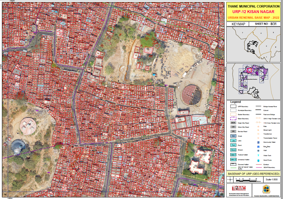

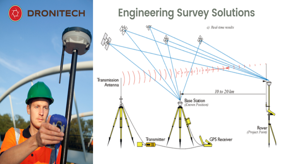


 Advanced Geospatial Surveys & Web GIS Solutions
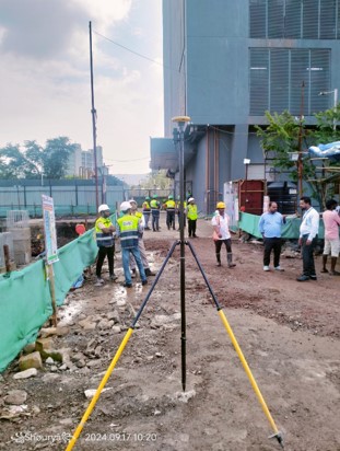
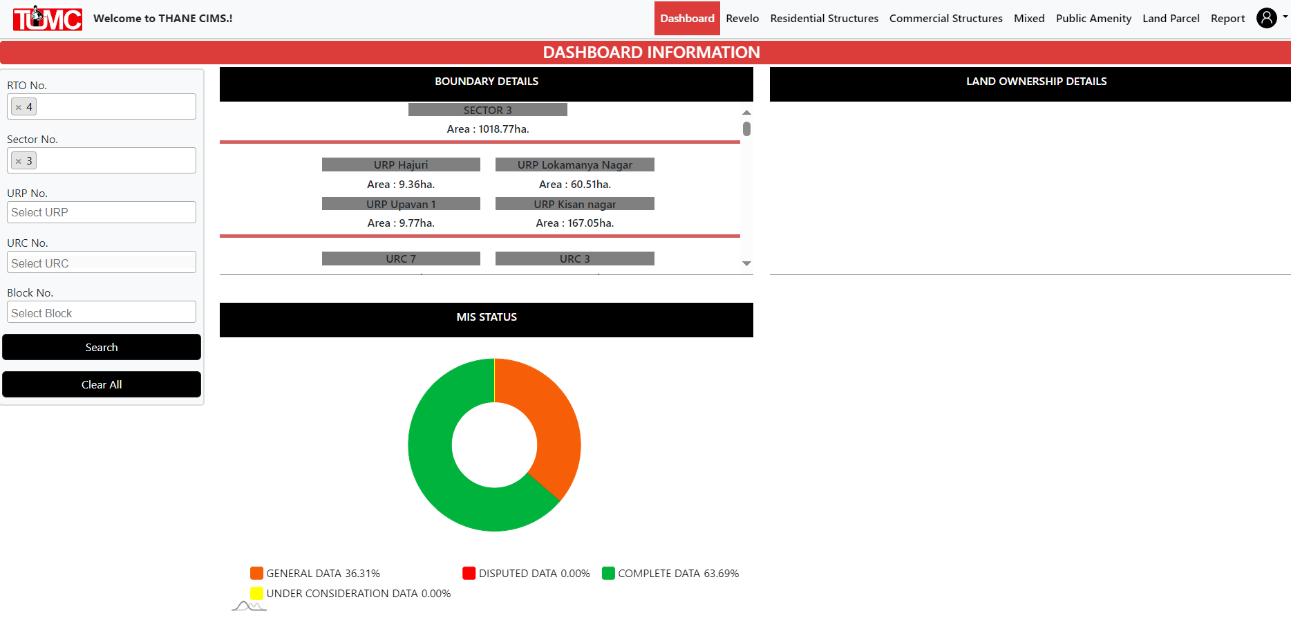
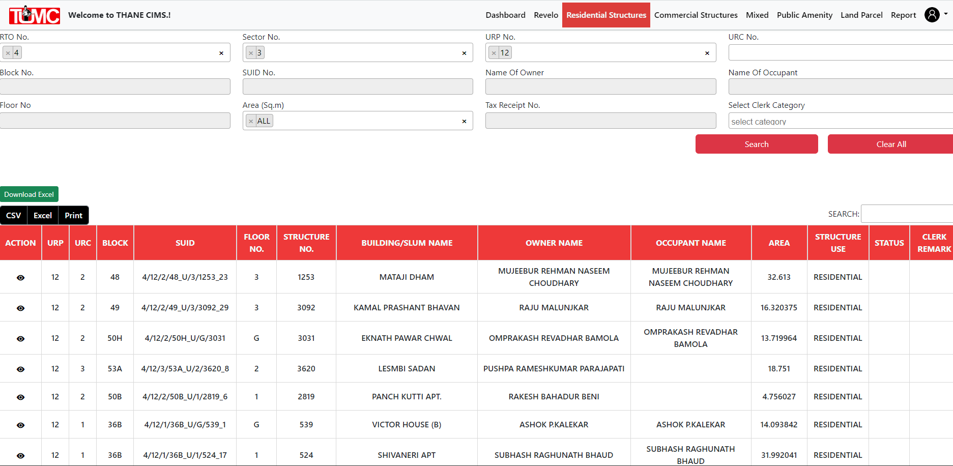
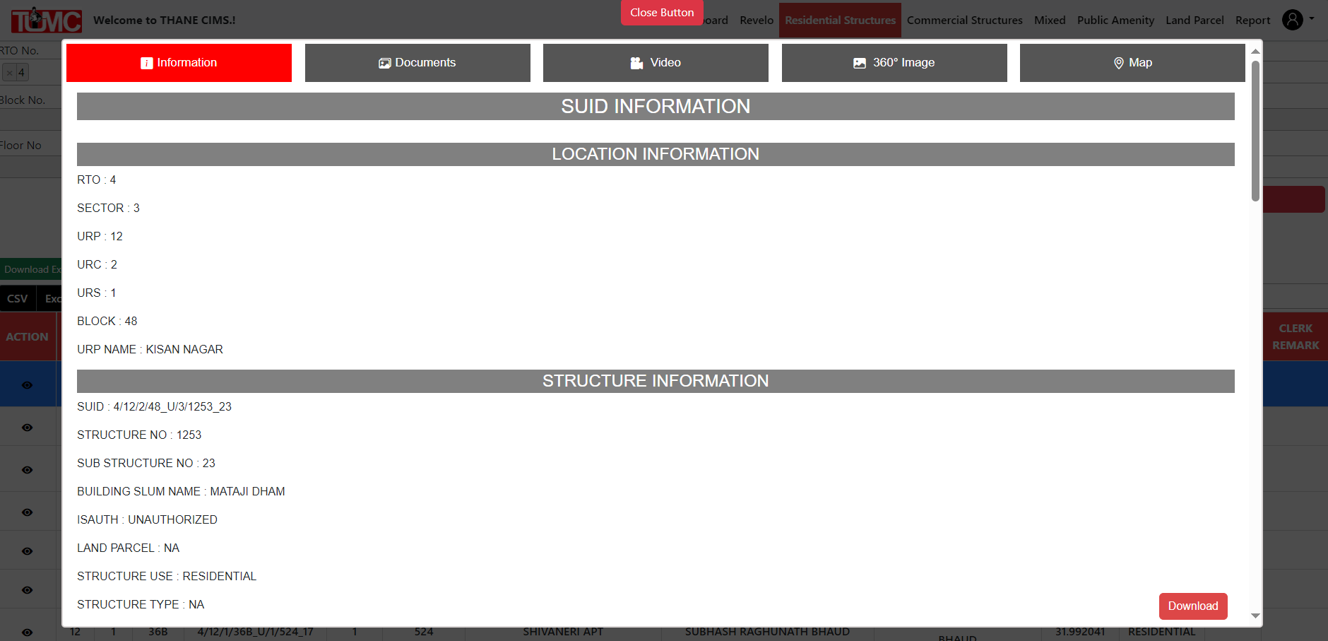
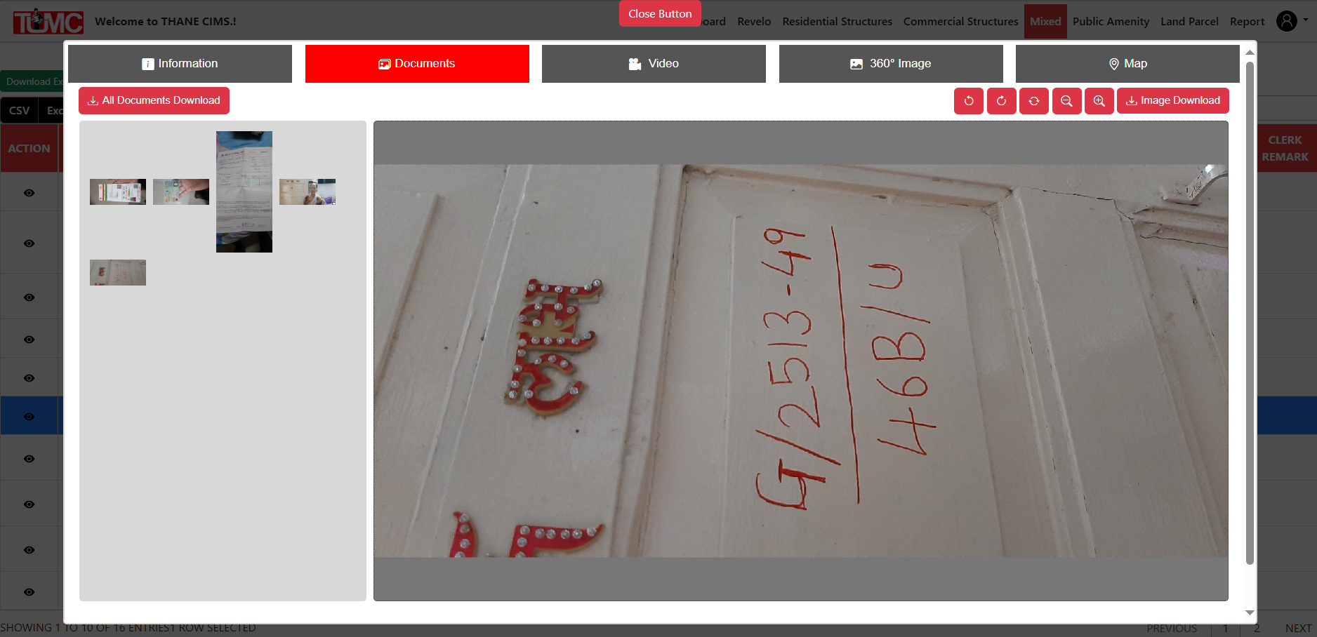
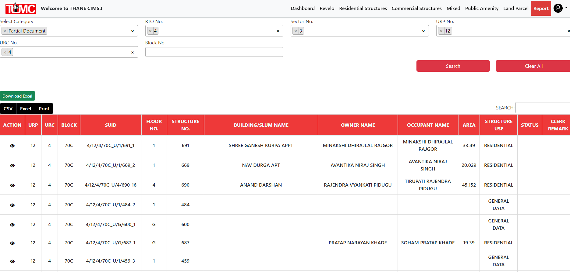
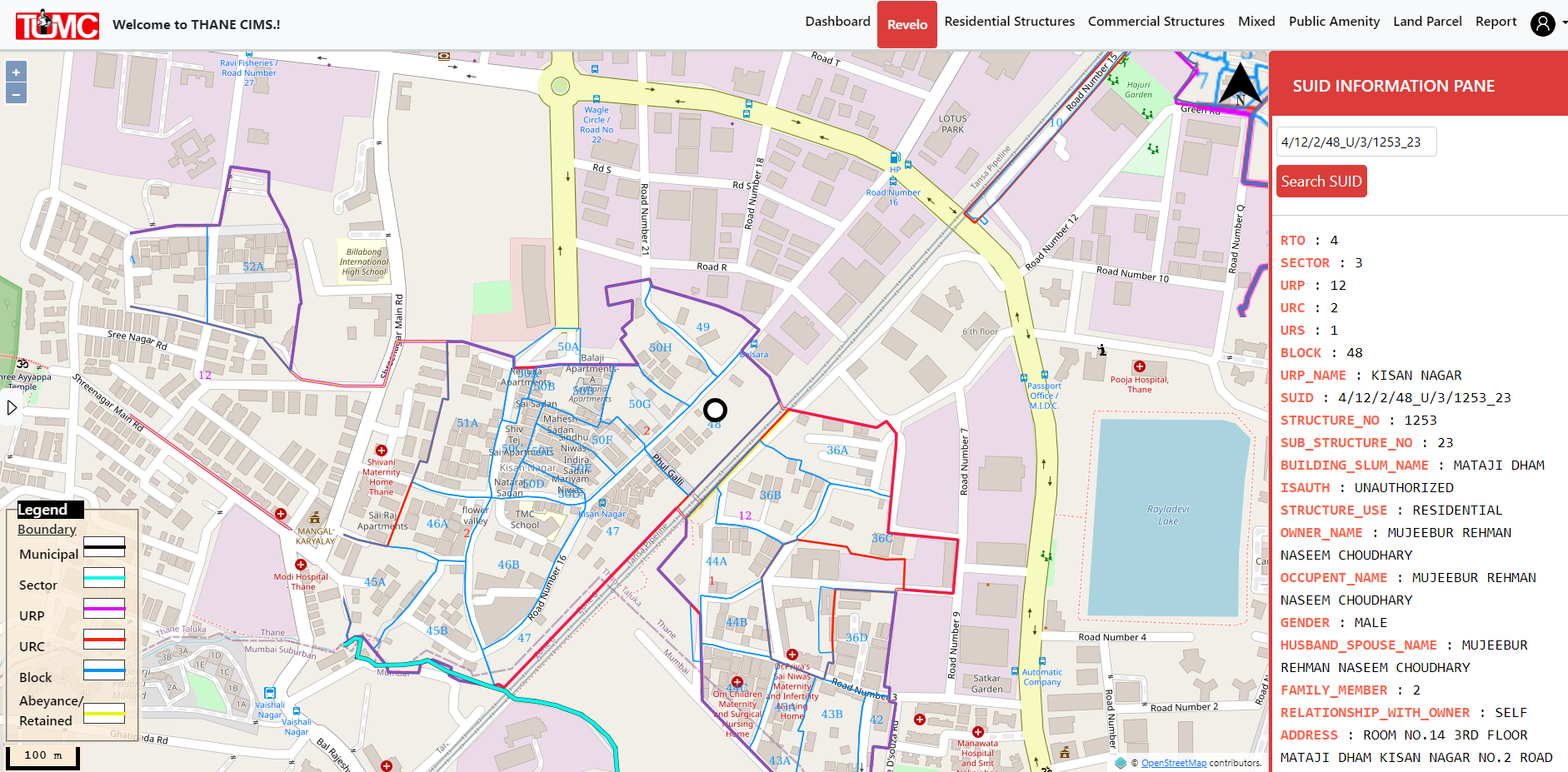
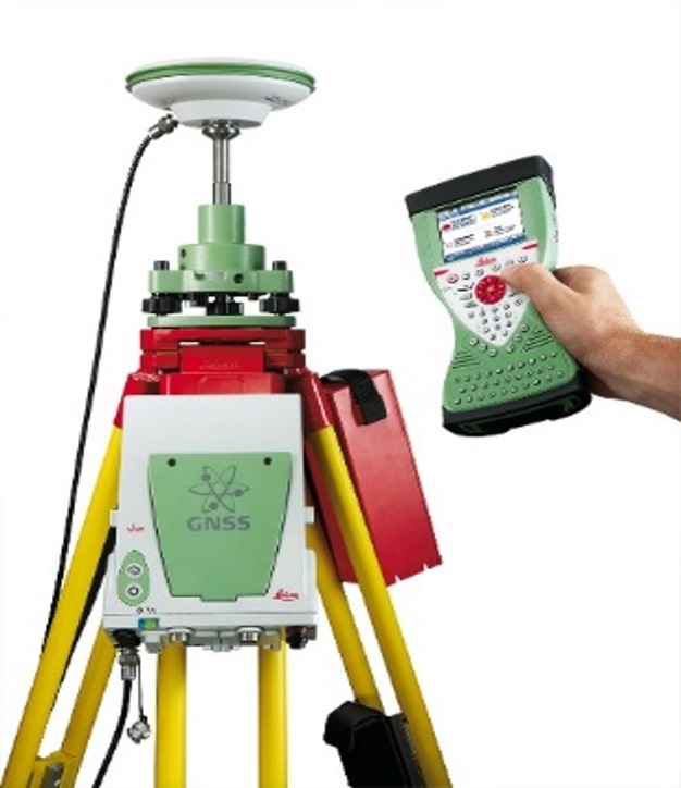
"With the use of Web GIS we analyze Geospatial Data Online through Interactive maps. It supports real-time Updates, Collaboration & Data sharing enabling Efficient decision making for Zoning, Land Use & Infrastructure planning. With Scalable, Cloud-based Solutions, we provide Timely, Data-Driven Insights for Sustainable Urban Development. We offer Comprehensive Geospatial Survey Solutions. Leveraging cutting-edge technologies to provide Accurate high-quality Data for a wide range of Applications. Our services include Topographic Mapping, Boundary Surveys, Environmental Assessments & Urban Planning by utilizing Advanced tools such as GPS, GIS, Drones & LiDAR. We specialize in Integrating & Analyzing Data from multiple sources into a Single user-friendly Platform for Seamless Viewing & Decision-making. We develop Custom Portals that allow clients to Access, View & Analyze Geospatial Data with Ease. Whether it's Land Development, Resource Management or Infrastructure Planning. Our Expertise in Geospatial Surveys ensures that you have the Precise Information you need to make Informed Decisions.